A Brief History of James Imray
A short of exploration of the history of James Imray Maps, from the early days in Spitalfields to leading the way in navigational cartography.
The Story of James Imray Maps
A Voyage Through Nautical Cartography
The history of nautical charting is filled with innovation, adventure, and the spirit of exploration. Among the most renowned names in maritime cartography is James Imray, whose maps have guided countless mariners safely around the globe.
Early Beginnings
James Imray was born on 16 May 1803 in Spitalfields, London. As a young adult, his vocational path was as an apprentice stationer. He was fortunate to witness a time when global naval exploration was rapidly expanding. With this in mind, his professional title switched from that of stationer to a Chart Publisher. Despite being registered as bankrupt in 1843, he went on to become a successful business man, and at the time of his death, his estate was worth just under £35,000. He had, so to speak, successfully navigated his career with remarkable cartography and marketing skills.
Pioneering Nautical Charts
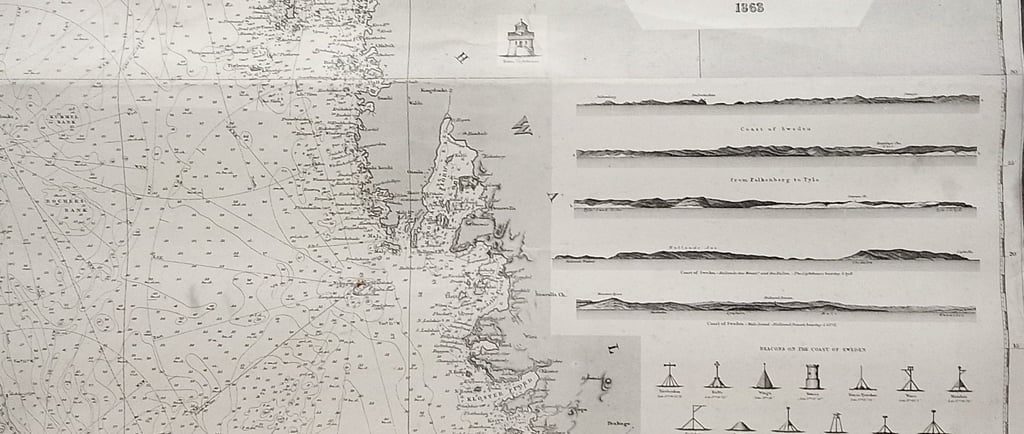
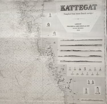
Imray’s vision was to create charts that were not only meticulously detailed but also regularly updated, reflecting the ever-changing nature of marine routes. Using surveys from British naval ships and commercial vessels, the firm produced charts of exceptional clarity and reliability. Imray maps soon became synonymous with safety and precision. They also were noted for being mounted on blue paper making them considerably more robust than those produced by the Admiralty.
Growth and Global Influence
As Britain’s Empire expanded, so did the demand for trustworthy maps. Imray’s charts covered not only the waters surrounding the British Isles but also remote regions in the Americas, Asia, Africa, and Australasia. Ship captains, merchants, and naval officers relied heavily on these maps to navigate unfamiliar territories. The company forged partnerships with other cartographers and hydrographers, ensuring their charts remained at the cutting edge of accuracy.
recolligo
© 2025 recolligo. All rights reserved.
Subscribe to our newsletter
07928278891


Sign up to our newsletter for exclusive offers. new arrivals, and inspiration on sustainable gifts. Follow us on social media for sneak peeks, behind-the-scenes stories , and tips on caring for your vintage finds.