Antique Kattegat Nautical Map (1868)
Historic maritime chart featuring the Kattegat, published in London
£120.00£98.00
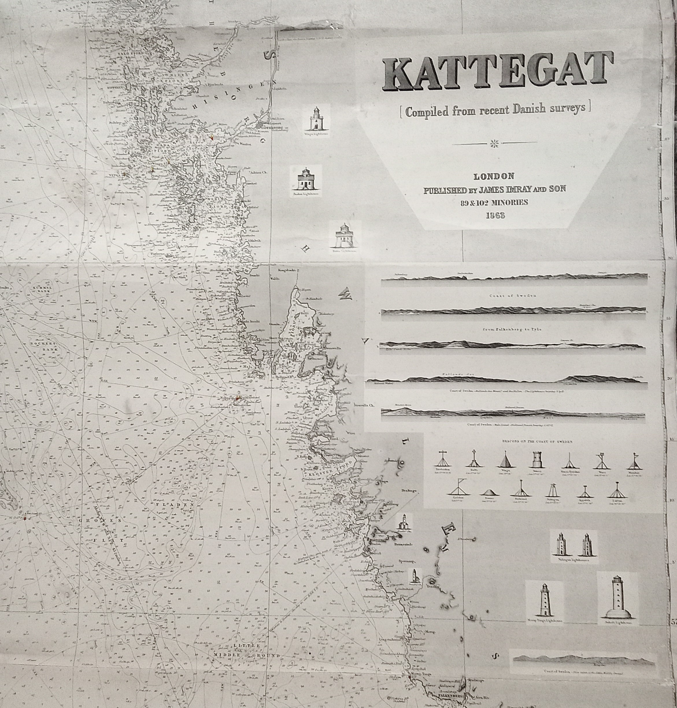
Original 1868 nautical map of the Kattegat by James Imray and Son, based on Danish surveys.
This historic chart shows coastal features and lighthouses in detail and is ideal for collectors or as a statement piece for lovers of maritime history.
The map’s muted tones and aged patina create a strong visual presence in a study, office, or living space.
Condition
The map is backed with blue paper, a known feature of maps by James Imray & Son.
Due to age and use, there are visible signs of wear including staining, creasing, and tears. Please refer to the photographs for details.
Further Reading
To learn more about the map’s maker, read our blog article “A Brief History of James Imray” on our website.
Dimensions
Approximately 104 cm x 129 cm
Postage & Packing
Our commitment to protecting and preserving the planets resources means we use a selection of recyclable, reused or biodegradable packaging as per availability.
We currently deliver throughout the UK. For international enquiries, please contact us directly.
This item is priced as per a medium parcel of 5 kg. Please select which Royal Mail postage option you require at the checkout.
recolligo
© 2025 recolligo. All rights reserved.
Subscribe to our newsletter
07928278891


Sign up to our newsletter for exclusive offers. new arrivals, and inspiration on sustainable gifts. Follow us on social media for sneak peeks, behind-the-scenes stories , and tips on caring for your vintage finds.